Showing posts with label Ute Mountain Tribal Park. Show all posts

Sunday, May 29, 2011

Sun Calendars Tour-Ute Mountain Tribal Park

The Sun Calendar Tour in Ute Mountain Tribal Park is a special tour of the Mancos Canyon area and is usually offered in late May. The tour starts at the main park entrance, south of Cortez in southwest Colorado. The tour focuses on special petroglyphs in the Mancos Canyon area. Most of these sites are near the sites that are visited on the regular tours.

The first stop is an isolated boulder not far from the park entrance. There is a four ring spiral on the south side, but it is the odd arrangement of the boulders that make this a sun observation site. From this point, the point where the sun rises and sets along the canyon rim through the year can be noted.

On the north side of the boulder there is a panel that includes several animal related figures. The tour included a stop at the Red Pottery Village, a stop that is also in the regular tours. The Red Pottery Village has several large rubble pile ruins sites and a tremendous amount of artifacts visible on the surface. This village may have been the center of the Mancos Canyon community at one point.
 
The Many Cliffs area is usually on the regular tour and has some small ruins sites and a petroglyph and pictograph panel. The Sun Calendar image of interest is to the left of the lower small ruins site on a triangular wedge of stone. There is a five ring spiral above a grid, with five tick marks below the grid. On the winter solstice, the moving shadow aligns with each ring and tick mark. The grid is thought to represent the farming fields.

The next site has the largest spiral that has been found in this area. The importance of these sun calendars is that the growing season here is barely long enough for the corn crop. The ideal planting time is a short time before the summer solstice. Planting too early could lead to failure due to a late spring freeze.

The winter solstice is a time for ceremonies. Much of the religious activity is thought to relate to rainfall and the planting and fertility of the crops. The area around the large spiral has other rock art and small ruins.

 The highlight of the sun calendar tour is the Butterfly site. A pointy rock directs a shadow across two side by side panels. The left panel is thought to represent the creation story and the right panel the emergence story.


The figures on the left include the spider, a spiral for the sun, the God of Land, thunder clouds, and a Kokopelli. These figures are symbolically touching. The thunder cloud image resembles a butterfly at first glance, but has five tick marks at the bottom, similar to the grid figure we saw earlier.
 
The symbols on the right are thought to represent the moon, the Evening Star i.e. planet Venus, several human figures, and the man made groove represents the place of emergence. Further to the right is a hole in the rock thought to represent the Sipapu connection with the earth that is also seen in some kivas. This panel could be 1500 years old, suggesting that these religious ideas have been constant for centuries.


The final stop was at Kiva Point, one of the regular tour stops. There is a short trail here. The trail visits several petroglyph panels, overlooks a great kiva, and there is a large display of pottery shards and other artifacts. Kiva Point is one of the most important areas in Mancos Canyon. The Sun Calendar tour focused on one of the petroglyph images that included many small dots. There is a pattern in these dots that suggests that this might be a yearly calendar, representing 365 days.


The tour I was on started at 9:00 AM and returned at 1:10 PM. The cost was $29 dollars and included transportation into Mancos Canyon.


Saturday, September 4, 2010

Turning Red Tail Hawk Trail- Ute Mt. Tribal Park

The Turning Red Tail Hawk Trail is a new tour offered for the first time in 2010 in Ute Mountain Tribal Park in southwest Colorado. This hike visits the Morris 3 cliff dweller ruins site in Johnson Canyon.

The trail head area is the same as the Lion Canyon Overlook Trail, a 10 minute hike to a viewpoint with cross canyon views of the four alcove ruins sites that are on the regular all day tour offered at Ute Mountain, including the spectacular Eagles Nest House. Some of the regular tours will visit this viewpoint, depending on the guide.

From the spectacular viewpoint, the trail plunges over the edge and down a long ladder. This segment is slow going down to a ledge area where the trail curls around the lookout point and up Johnson Canyon. The trail and ruins site has been stabilized recently.

The Morris 3 site was first worked on by Earl Morris in 1913. It takes about one hour of travel on the gravel roads in Ute Mountain Park to arrive at the trail head, similar to most of the tours here.

The trail is similar to the Petroglyph Trail in Mesa Verde, working along a cliff face below the rim but well above the canyon bottom. There are many ups and downs and careful stepping involved. There is a second small ladder about midway along the trail

Along the cliff face there are two small well preserved granary structures visible above the trail and a small alcove that is a ruins site, but without much stonework remaining. There is also a small granary site visible across Johnson Canyon and patches of Douglas Firs in the drainages across the way. There are supposed to be many rarely visited pit house sites on the mesa top across the canyon that Morris investigated long ago.

The stabilized trail enters the Morris 3 site from the left and crosses along the front with a route to enter for a close view. Our group size was only 11 and this was the first tour ever offered of this site.

The D shaped kiva at the back of the site was probably the most eye catching of the larger features. The large logs are still in place resting on the pilasters. The D shape is one of two side by side kivas partially tucked up under the alcove. The bottom features have been left unexcavated. Some of the plaster remains on the masonry interior walls.
Like many of the Mesa Verde area sites, different styles of masonry are visible. The Ute Mountain sites have been left much as they were originally found, with a lot of rubble still lying around the sites. There are also many pottery shards and corn cobs visible here. I saw mostly the corrugated style and not many with painted designs. The guide made the comment that in the early years of Mesa Verde, the boundary was not clear and many of the pottery shards from this site may have been collected by early visitors.

There is another large kiva on the right end of the site. The Morris 3 site has about 28 rooms and is thought to have been built around 1210 AD. It took our group 0:55 minutes of hiking from the trail head to arrive at the site, a distance of about 1.25 miles.

The tour visited the site for about 0:40 minutes and then we were allowed to return at our own pace to the trail head. There is a shade structure and picnic tables at the trail head where we rested and ate lunch for about 1:30 hours before traveling back to the visitor center.

The actual hike and ruins visit took about 2:30 hours for 2.5 miles out of a total experience of 5:45 hours. The cost of the tour was $38 which included riding in the van and a cold drink at the shade structure during the lunch break. This is one of the rare special experiences offered by Ute Mountain Tribal Park.


Sunday, May 30, 2010

Porcupine House Trail-Ute Mt. Tribal Park

The Porcupine House Trail is an infrequently offered guided tour to an Ancestral Pueblo cliff dweller site in Ute Mountain Tribal Park in southwest Colorado. This tour was offered as part of the annual open house that is usually at the end of May.

The site location is in Pitch Pine Canyon, a side canyon of Johnson Canyon on the south side of Mesa Verde. The access is from the main park entrance at the lower end of Mancos Canyon south of Cortez, CO. It is in the vicinity of the regular full day tour hike at Lion Canyon.


From the canyon rim only the upper level of the site is visible. From above, it looked like there were a few storage ruins here, but much is obscured by the thick vegetation. The canyon floor vegetation is dominated by Gambel Oaks and Ponderosa Pines, an unusual combination in the areas where the cliff dwellings are found. Usually the Pinon Pines and Utah Junipers are found in these canyons with occasional Douglas Firs in the deeper and moister locations.


There are two ladders installed to descend. This canyon is oriented north and south with the main structures facing east rather than toward the more typical south. There is a collapsed tower on the rim right next to the ladders. There is a drainage channel from the rim area that flows across the rough slickrock right into the ruins area, but I didn’t see a seep spring here. The bottom area is very thick with the Gambel Oaks.

This site has been worked on to some extent, but not as much as the large and famous Mesa Verde sites. There is a trail marked along the front of the site and there has been some excavation in places. Most of the Ute Mountain sites have been left as they were found, with little work done on them.

The Ute Mountain sites feature a lot of artifacts on display. There are pottery shards, corn cobs, grinding stones and other small tools. The small guided groups have kept these artifacts available for viewing. Most of the pottery shards are the corrugated types that were typically from cooking pots. There are also some black on white designed pieces.


A large kiva that looks like it has had excavation work is one of the highlights. The Porcupine House has about 50 total rooms and about 5 kivas. The kiva has the bench and pilaster features that are common to the Mesa Verde style kivas. There isn’t room here to step back and get a wide view of the many rooms. All the views are close ups.
One of the unusual artifacts visible at this site was an example of a small sandal made from Yucca fiber. The guide mentioned that it was thought that Yucca had been planted at this relatively cooler site. Yucca was the main fiber that was available to the people living here. It is surprising that an item like that, more than 700 years old stays so well preserved. This site also had more grinding stones visible than most sites that can be visited.

At the end of the trail the group has to turn around and retrace their steps back to the starting point. There is an option to try climbing out along the original route in and out rather than climb the ladders.

The total tour to Porcupine House took 7:00 hours with about 2:00 hours spent at the site. There were also two stops at Mancos Canyon pictograph and petroglyph sites that are part of the regular tours. There were also stops at the park campground and the trailhead area for the regular tour of Lion Canyon.

Mancos Canyon Tour-Ute Mt. Tribal Park

Near the Mancos Canyon Road entrance to Ute Mountain Tribal Park in southwest Colorado are several easy to visit Ancestral Pueblo sites. These sites are part of the typical half day tour offered here. The full day tour goes on to the Lion Canyon Trail to visit a series of four cliff dwellings.


The Old Visitor Center was used from about 1971 to 1981 with the prominent Chimney Rock looming overhead. At first glance I thought this was an old jail. The wooden door was very thick and solid. Ute Mountain Tribal Park is the south side of Mesa Verde and is lightly visited.


The Red Pottery Village is an unexcavated village site where a lot of red pottery has been found. There are displays of pottery shards and artifacts in the field among the rubble mounds. The museums in the area say that the center of red pottery production was in southeast Utah and the Kayenta area of northeast Arizona, and any found near Mesa Verde would have been traded in.


This is one of the interesting features of the park, the visibility of these artifacts from a culture of more than 700 years ago. The artifacts are safe as all visitors are escorted by a guide. Across the canyon in this area a Hovenweep like tower is visible but the tour doesn’t go over to it.


Many Cliffs Ruins is a small site of small rooms tucked into the cliffs not far above the road. These small rooms are common in the region but are often overshadowed by the spectacular larger alcove ruins. Directly below the larger ruin and left of the smaller one there is an example of one of the Sun Calendar petroglyphs. There is a spiral and a grid that measures the movement of the sun, but it is hard to see from the road without binoculars.

About 200 yards back to the west of this site there is another petroglyph and pictograph panel with a trail up the cliff that allows a closer view. It may depend on who the tour guide is for the group to visit there.


There are many handprints, some broad shouldered figures and a footprint petroglyph. Occasionally there are special hikes that focus on the Sun Calendars along the Mancos Canyon. Usually the Sun Calendar hike is in late May.


The Chief Jack House Site was the home site of the last traditional chief of the Ute Mountain Utes and he was the one who proposed the Ute Mountain Tribal Park around 1970. There was initial opposition to the park and his house was burned down.


The Pictographs at the site are thought to have been painted by Chief Jack himself. The short Kiva Point Trail is also part of the Mancos Canyon Tour. There are easy to see petroglyphs and a large unexcavated Great Kiva.

The final stop in Mancos Canyon is the Kiva Point.  (Kiva Point has a separate post with more pictures.)


Tuesday, August 11, 2009

Inaccessible House Trail

Inaccessible House is located below the east rim of Navajo Canyon in Ute Mountain Tribal Park in southwest Colorado. It is rarely visited, but is included on a special tour along with the nearby Casa Colorado ruins site. The trail head is in the area south of the Mesa Top Tour at the south end of Mesa Verde National Park. This hike has been offered once per year since 2009.

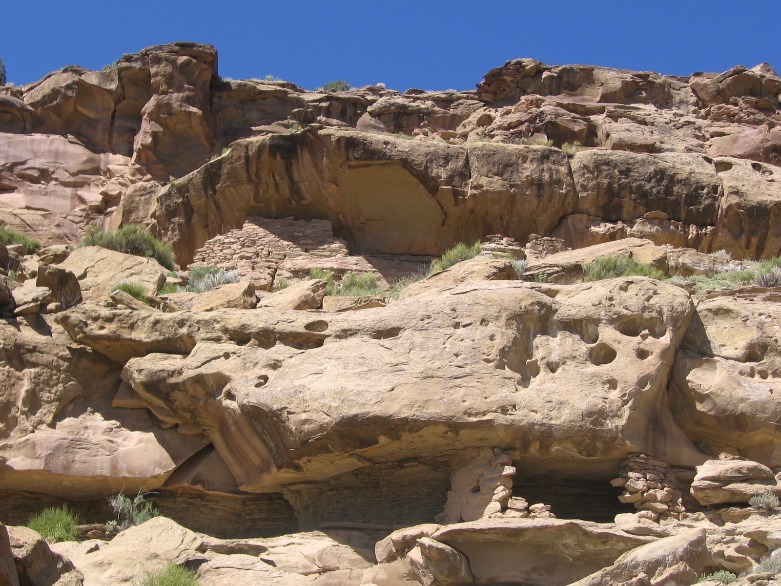
The trail runs south along the Navajo Canyon east rim to an unnamed side canyon where the Casa Colorado ruins sits at the side canyon head. A rough trail descends into the side canyon and turns back toward the main canyon and runs under the rim. The Inaccessible House site is above the trail at a somewhat awkward viewing angle, and seems to be very well preserved.

At the canyon junction a short distance before the site there are some historic inscriptions from some of the early visitors to the area. The 2009 hike was guided by one of the experts in the history of Mesa Verde and there was a good discussion of who the inscribers were and what their roles were in the early history of the area. There are several inscriptions on the canyon walls here.

The trail continues past the Inaccessible House site to another alcove that has only rubble piles remaining but also has a small reddish pictograph panel.

The wrecked nature of this alcove site was attributed to rough use during the pot hunter era of the early 1900s. This second site has several grinding and sharpening sites also.

Beyond the second alcove there is a small granary site. The trail along here was reasonably good despite not much maintenance over the years. The Ute Mountain Tribal Park has mostly left these sites in the state that they were found. Pottery shards are visible and remain in place as all hikes here are guided. I noticed a second granary site on the return hike near the inscription rock, so there are three intact ruins in this area plus the pictograph alcove.

Inaccessible House doesn’t appear to be a place that anyone would have resided in, maybe it is a special use site. It is hard even to see it.

The quality of the stonework seems to be particularly fine here. The stones that are visible seem to be very well shaped.
There isn’t any room to step back and get a good view. Our tour group visited this site and those with enough energy left continued on to nearby but harder to get to Casa Colorado. On the 2011 hike the order of the visits was reversed. Casa Colorado was visited first. Casa Colorado is an easier site to view but the trail to Inaccessible House has more features.

On the 2011 return hike, there is a view point for Inaccessible House from the rim. The total tour in 2009 took about 6:30 hours with about half the time spent at each of the two sites. The 2011 tour took about 5:00 hours, with less time spent on Casa Colorado. The distance covered was about 3 miles but the route was somewhat difficult and required some scrambling up and dwn in the rocky environment.

Sunday, August 9, 2009

Casa Colorado Trail

Casa Colorado is a rarely visited Ancestral Pueblo cliff dweller ruins site in Ute Mountain Tribal Park in southwest Colorado. Ute Mountain Tribal Park offers guided full day and half day tours and a few special tours such as this hike to Casa Colorado and Inaccessible House. The 2009 summer season was the first year this hike was offered and it was offered once also in 2010 and 2011.


The trail head area for Casa Colorado is accessed at the south end of Mesa Verde National Park in the vicinity of the Mesa Top Pit House to Pueblo self guided tour. This is the same beginning area for the Pool Canyon Trail, another of the rarely offered Ute Mountain tours. After a short drive across the park boundary the hike begins along the east rim of Navajo Canyon.

The popular Spruce Tree Canyon area is a side canyon to the north of this section of larger Navajo Canyon. The hike along the rim is about 0.5 miles to an unnamed side canyon with Casa Colorado at the head of this short side canyon.

There were at least 3 ruins sites visible across the Navajo Canyon the west side. One of them we thought was named Casa Blanca and there also appears to be a tower visible. You would need binoculars to see these distant sites very well. At the canyon bottom there appears to be an old road.

There is an old 1930s era trail just below the rim heading east to toward the ruins site but it is unmaintained and wasn’t obvious on the outward leg. In 2009, most of our group made their way slowly through the Pinon Pine and Juniper forest but mostly not on any trail. The route was somewhat difficult and there was some scrambling through and over the jumbled rocks. The distance was only about 0.3 miles and the ruins site was visible most of the way.

On the 2011 hike to Casa Colorado, the tour stayed on the north rim of the side canyon and circled around the canyon head, then approached the Casa Colorado site from the south side. Those who wanted could try to descend down to the next ledge and view the site from the right side.

Casa Colorado is difficult to approach no matter which way you try. The 2011 approach involved some tricky climbing.

The trail approaches from the left side. It was possible, though not easy, on the 2009 hike, to approach the Casa Colorado closely from the right side by descending to the canyon bottom and climbing up the other side. It looked like the right side would have been the main entrance.

In 2009, a few of our active group chose to climb to the canyon rim from this right side of the site, going out over the top of the ruin, but most returned back the way we came. In 2011 the right side climb was the guided way in. The return trip was a little easier, and was mostly on the old trail below the rim.

The total hike to Casa Colorado and nearby Inaccessible House was about 6:30 hours with about half the time spent at each site. The total distance was only about 3 miles but the going wasn’t easy and there was a lot of lingering at each site.


18407_$5 Shipping on Orders of $99 or More! 544544_$20 off any hotel booking of $350 or more with code TLSALE20