Saturday, December 25, 2010

Sun Temple on the Mesa Top Tour

The Mesa Top Pit House to Pueblo Tour is a ten stop self guided tour that traces the development of building styles at Mesa Verde National Park in southwest Colorado. During the busy summer, most visitors will move their vehicles between the stops.

In winter, the segment between the Square Tower House Overlook and the Sun Point Overlook is a 3 mile round trip hike on a hard surface that is cleared of snow and free from mud. One of the dozen or so ruins structures visible at Sun Point is the mysterious Sun Temple, visible on a point to the left of the famous Cliff Palace. It is another 0.5 miles of road past Sun Point to arrive at the Sun Temple.
 
Visitors enter the site from the west side and circle around to the south side. It is hard to see, but the overall structure is D shaped, has thick walls and most of the structure has a row of narrow rooms around the outside. On the south side, there is an indent in the wall with a small square opening on each side.
 
Looking in through the small openings, there are views on each side of the line of connected small rooms. There aren’t any apparent exterior doorways anywhere around the whole building.
Outside the southeast corner of the Sun Temple, there is a large circular tower. Along this same side, there is a good view of the Cliff Palace across the canyon.
 
There is a rock outcrop on the north side of Sun Temple that allows a view over the walls. On the interior, there is an open area with two circular kivas. No roof materials or household goods were found here, and it appears that this structure wasn’t completed before the entire region was abandoned around 1300 AD.


Tuesday, November 30, 2010

Far View House Plaza

The Far View Trail at Mesa Verde in southwest Colorado is a short distance from the main park road and can be accessed and hiked during the winter season. Bring snowshoes in mid winter as there can be several feet of snow covering the trail. I hiked on a 30 F degree late November day with one or two inches of recent early winter snow.

Far View House and Pipe Shrine House are the two large ruins sites at the trailhead area, across a plaza from each other. Far View House was named by Dr. Jesse Walter Fewkes during the 1916 excavation for the wide views of the Four Corners area. These views today can be more readily seen from the Far View Visitor Center to the north, than from the plaza area between the large pueblo sites.

Among the 40 ground floor rooms of Far View House are 5 kivas, but only the one outside the main walls is visible. The height of the remaining walls at Far View House limits the view into the interior. One of the invisible interior kivas is particularly large and includes some features that are seen in the kivas found at Chaco Canyon in northwest New Mexico.

There are a couple of places along the front wall where the doorways line up and there is a view through a couple of rooms. The location and size of Far View House suggests that it may have served as a public building. This is also said of some of the large structures at Chaco Canyon.

Pipe Shrine House has 20 rooms and is just a short walk south of Far View House. The walls on the south side are two courses thick and thought to be the most recent work. The Pipe Shrine name comes from a dozen clay pipes found in the large kiva during the 1922 excavation.
 
The north side of the site shows the single course walls that are considered to be the older style. There are six large and varied excavated ruins sites on the one mile Far View Trail. It is easy hiking with a lot to see.


Saturday, November 27, 2010

Coyote Village Corn Grinding Stones

Coyote Village is one of six large Ancestral Pueblo ruins sites on the 1 mile Far View Trail in the Chapin Mesa area of Mesa Verde National Park in southwest Colorado.


Coyote Village is an overlooked site on an overlooked trail. Most visitors by-pass the Far View Trail for the spectacular cliff dweller sites, but there aren't many trails where so many easy to view sites are so close together.


One of the features of Coyote Village is the two examples of side by side grinding stones separated by stone partitions. One set of six grinding positions appears to be inside a structure and the other set of three is outside. The other Mesa Verde site where I've seen side by side bins is at Mug House on Wetherill Mesa.


Besides pottery shards, the artifacts a hiker might see at ruins sites are the grinding stones. The slabs are usually called metates and the hand held stone is called the mano. The Chapin Mesa Museum has displays of grinding stones. The Anasazi Heritage Center in nearby Dolores, CO has a display that gives more of a textbook description of the types of metates and manos.

The three styles of metates are basins, troughs, and slabs. The basin is the oldest style with the grinding done in a circular motion. The trough uses a back and forth motion with a one handed or two handed mano stone. The slab style is a flat stone and provides a larger surface area for a one handed or two handed mano. The flat slab is thought to be the most efficient of the three styles.

The mano hand stones are called biscuits if the diameter is less than 3 inches. Larger than 3 inches the biscuit becomes a one handed stone. The two handed stones used with the trough style metates show an upturned wear pattern at the outer edges.
 

Long House on Wetherill Mesa has a display of metates in the back of the alcove next to one of the seep springs and the sandstone ripple marks. This collection appears to be mostly slabs.


Balcony House has a similar small display near the hands and knees tunnel exit.
 

Basin style grinding stones don’t seem to be very common in the museum displays, but the Aztec Ruins in Aztec, New Mexico has what looks like one in a random place near the beginning of the trail.


The Mesa Verde Chapin Mesa Museum has a display of how the bin style grinding works with some corn flour included. A note on the display says the current day Pueblo women still practice hand grinding of corn and they say it is their most difficult and wearisome task.


18407_$5 Shipping on Orders of $99 or More!

Sunday, October 10, 2010

Wetherill Mesa Hike and Bike

Mesa Verde National Park in southwest Colorado held a second Wetherill Mesa Hike and Bike day on October 9, 2010. Wetherill Mesa has the second largest concentration of Ancestral Pueblo ruins sites in the park, but is usually only open in the summer season between Memorial Day and Labor Day.

On this special day, the 5.4 mile paved tram road is open for hiking and biking to the several sites. Visitors park at the information kiosk as usual, and then set out on the tram road or the normal hiking trail.

One of the best opportunities is that the trail to the very large Long House ruins site is open for a leisurely visit. During the busy summer season, a $3 guided tour is the only way to visit this impressive site.

The hike along the tram trail to the Long House trailhead is about 0.75 miles and took me about 20 minutes. The trail leading to Long House descends below the canyon rim along stairs for another 0.75 miles with spectacular views of the Rock Canyon area.

Normally, visitors arrive on the tram and hike in groups of up to 60 with no opportunity to pause along the trail and take in the views or examine the Pinon Pine and Utah Juniper forest.

Two or three of the Park Rangers were stationed in Long House to provide information for the stream of visitors, but there was no formal presentation. During my visit there seemed to be about 20 visitors trickling in and out, well spread out in the large alcove. In early October, the lower sun angle puts more of the structures in bright sunlight. It was easy to stop and find viewing angles that are unobstructed and there is no pressure to keep moving with a group.


 Long House was excavated in 1959-61 as part of the Wetherill Mesa Archaeological Project, one of 15 sites worked on from 1958 to 1963. It is estimated that 150 to 175 people lived here from about 1200 to 1300 AD. The back of the alcove has several special features including the seep spring water supply, several vague pictographs, a collection of grinding stones, and a kiva with part of the roof still intact. Usually the line to climb the small ladder to view the interior of this kiva deters me from looking, but on the special day I finally had my chance.

 The landing area between the two ladders that lead to the back of the alcove provides a good overview of the featured plaza area. On the normal tour, visitors are focused on staying in line to climb the ladders and don’t notice this angle.

The plaza area has some of the features that are found in Great Kivas, such as those at Chaco Canyon in New Mexico, or nearby Lowry Ruins, but isn’t enclosed by a wall and appears to have never had a roof. The regular tour gathers in the plaza and discusses the possible ceremonies, sometimes painting a picture of people even watching from the canyon rims as music and dances were performed.

After visiting Long House, I continued on the tram road to the junction at the trailhead for the Badger House Community and returned to the kiosk along the normal hiking trail. As part of the special day, a hamburger and chips lunch was available at the kiosk for $6. My hike and visit to Long House took 1:45 hours for about 3 miles of walking.


Monday, September 20, 2010

Wetherill Mesa Tram Trail

The Wetherill Mesa area of Mesa Verde National Park is usually only open in the summer months between Memorial Day and Labor Day, but on September 19, 2010 the tram road was opened for a special day of hiking and biking. This special day is among the new visitor activities in 2010 that have also included three new back country hikes.

The main attractions on Wetherill Mesa are the self guided tours at Step House and the four mesa top sites of the Badger House Community Trail along with the guided tour at the very large alcove ruins site Long House.


The tram usually provides transportation to these sites and the overlook to Kodak House and the trailhead for the Nordenskiold No. 16 Trail. Park Rangers were available to provide information and support for visitors biking and hiking the normally closed paved trail.


One of the highlights of this special day was that the trail to Long House was open for leisurely visits, with rangers stationed at the site to answer questions. Normally, Long House can only be visited as part of a guided tour, often in groups of 60 that need to keep moving to stay on schedule. Visitors could hike or bike the modest distance from the parking area to Long House and enjoy the canyon environment and large ruins site at their own pace.

Most of the 5.4 miles or so of paved tram road passes through areas that are recovering from the forest fire of 2000. The line between what was burned and what survived is often sharp. The recovering areas seem to have the colorful yellow flowers Rabbit Brush and the important Yucca plants growing along with grasses.


In some spots some small Junipers and Pines have started. It took me 2:00 hours to walk the tram loop without stopping at any of the major ruins sites except for the overlooks at Long House, Kodak House and the overlook area near Nordenskiold No. 16.


Part of the Wetherill Mesa festivities included a lunch special of a hot dog, chips, and cold drink for $5. It was a perfect 80 F degree mid September blue sky day and the parking area seemed to have as many vehicles as on a normal summer day.


Saturday, September 18, 2010

Wickiup Canyon Trail & Spring House

Wickiup Canyon is part of the Mesa Verde National Park backcountry in southwest Colorado. It sits between Navajo Canyon on the east and Long Canyon on the west, and normally can’t be seen from any of the normal trails or viewpoints. During the 2010 summer season, Wickiup Canyon is the middle segment of the 8 mile round trip ranger guided hike to the Spring House ruins site.
Near the junction of Spruce Canyon and Navajo Canyon, the trail veers up the west side of hidden Wickiup Canyon and climbs several hundred feet to the neck of Long Mesa before continuing on to the ruins site..


Though the trail through Wickiup Canyon has been lightly used in recent decades, it has history dating back to the Civilian Conservation Corps in the 1930s. The stone work of that era was built to last, still holding up well over the years.
Wickiup Canyon doesn’t have any of the very large ruins sites for which Mesa Verde is most famous, but has several of the 600 Mesa Verde smaller alcove sites that are scattered in these deeply cut canyons. Near the mesa top is a well preserved appearing circular structure that is usually described as a storage granary.

The largest and most visible site is Buzzard House across the canyon. This site appeared to have easy access from the canyon floor and difficult access to the mesa top. The canyon floor in this area doesn’t look very wide or particularly suitable for farming, so one might wonder if this was a residence site or for some other purpose. The wooden supports for the upper floors stand out well in the afternoon sun.

Lower in the canyon, there are several small wall sections visible with binoculars. One of these sites is perched on the edge below a triangle face of desert varnish painted sandstone. The small sites in this area all look very difficult for the residents to access. In a couple of places high near the canyon rim, there are unexpected trees visible. You don’t expect to see an aspen or a cottonwood clinging to the cliff walls in this area, but there are some.
On our mid September hike it took 3:10 hours to arrive at the trailhead to the short descent below the rim down to Spring House. About half of the outward leg is spent on the climb up Wickiup Canyon and viewing the several points of interest on the way. About 2:00 hours were spent visiting Spring House and enjoying the provided lunch of a ham and turkey sandwich with chips, a piece of fruit, and a small bottle of juice. I carried 4 liters of water and needed most of it. The return hike took 2:00 hours for a total backcountry experience of 7:00 hours on a blue sky 80 F degree perfect day.

The Spring House hike, along with Mug House and Wetherill Experience, was one of three special backcountry hikes offered on the trial basis in 2010.

Monday, September 13, 2010

Point Lookout Trail

The Point Lookout Trail is one of three hiking trails that leave from the Morefield Campground area near the entrance to Mesa Verde National Park in southwest Colorado. These trails give good views of the Montezuma and Mancos Valleys and the north rim of Mesa Verde itself.  


The Point Lookout Trail leaves from the large amphitheater parking lot and climbs 400 feet and allows views to both valleys. The round trip distance is 2.2 miles and the forest is Pinon Pine and Utah Juniper with a lot of Gambel Oak and a few Rocky Mountain Junipers.

The nearby Knife Edge Trail includes a trail guide that provides extensive information on the native plants that grow in Mesa Verde. The first part of the trail has all the climbing with many switchbacks through relatively lush forest.


The view to the east is toward the LaPlata Mountains and the town of Mancos, CO. The highest mountain in that group is Mt. Hesperus, the sacred mountain of the north that marks one of the boundaries of traditional Navajo territory. The trails of the Morefield campground provide some good hiking but are probably mostly skipped in favor of the famous ruins sites.


From the lookout point, the view to the west is toward Sleeping Ute Mountain and the town of Cortez, CO. The route of the Knife Edge Trail is visible just below the sandstone rim. It was the old road into Mesa Verde until 1957. Further west is the Hovenweep and Canyons of the Ancients area, rich with ruins sites.

Looking straight north from the sandstone cliff you can watch the park visitors wind their way up the twisty highway into the park. The Point Lookout looms overhead for those drivers, but they are probably keeping their eyes on the road. The eroded brown hills are the Mancos layer made up of soft clays and shales.

Near the lookout point, the trail passes through a mysterious circle of stones. There is no information that this is a ruins site, perhaps it was built by more recent visitors. It is positioned in a spot where it would be a good signaling point.

After visiting the circular tower structures at Mesa Verde and other sites in the region, many appear to be positioned at places with a line of site to other similar structures. Point Lookout has a line of site view to Park Point, the highest point at Mesa Verde, and a place that may have a line of sight as far as the Chaco Canyon area, as well as the valley below. It took me 0:40 minutes to climb to the lookout point and my hike took 1:20 hours total.

18407_$5 Shipping on Orders of $99 or More! 544544_$20 off any hotel booking of $350 or more with code TLSALE20

Saturday, September 4, 2010

Turning Red Tail Hawk Trail- Ute Mt. Tribal Park

The Turning Red Tail Hawk Trail is a new tour offered for the first time in 2010 in Ute Mountain Tribal Park in southwest Colorado. This hike visits the Morris 3 cliff dweller ruins site in Johnson Canyon.

The trail head area is the same as the Lion Canyon Overlook Trail, a 10 minute hike to a viewpoint with cross canyon views of the four alcove ruins sites that are on the regular all day tour offered at Ute Mountain, including the spectacular Eagles Nest House. Some of the regular tours will visit this viewpoint, depending on the guide.

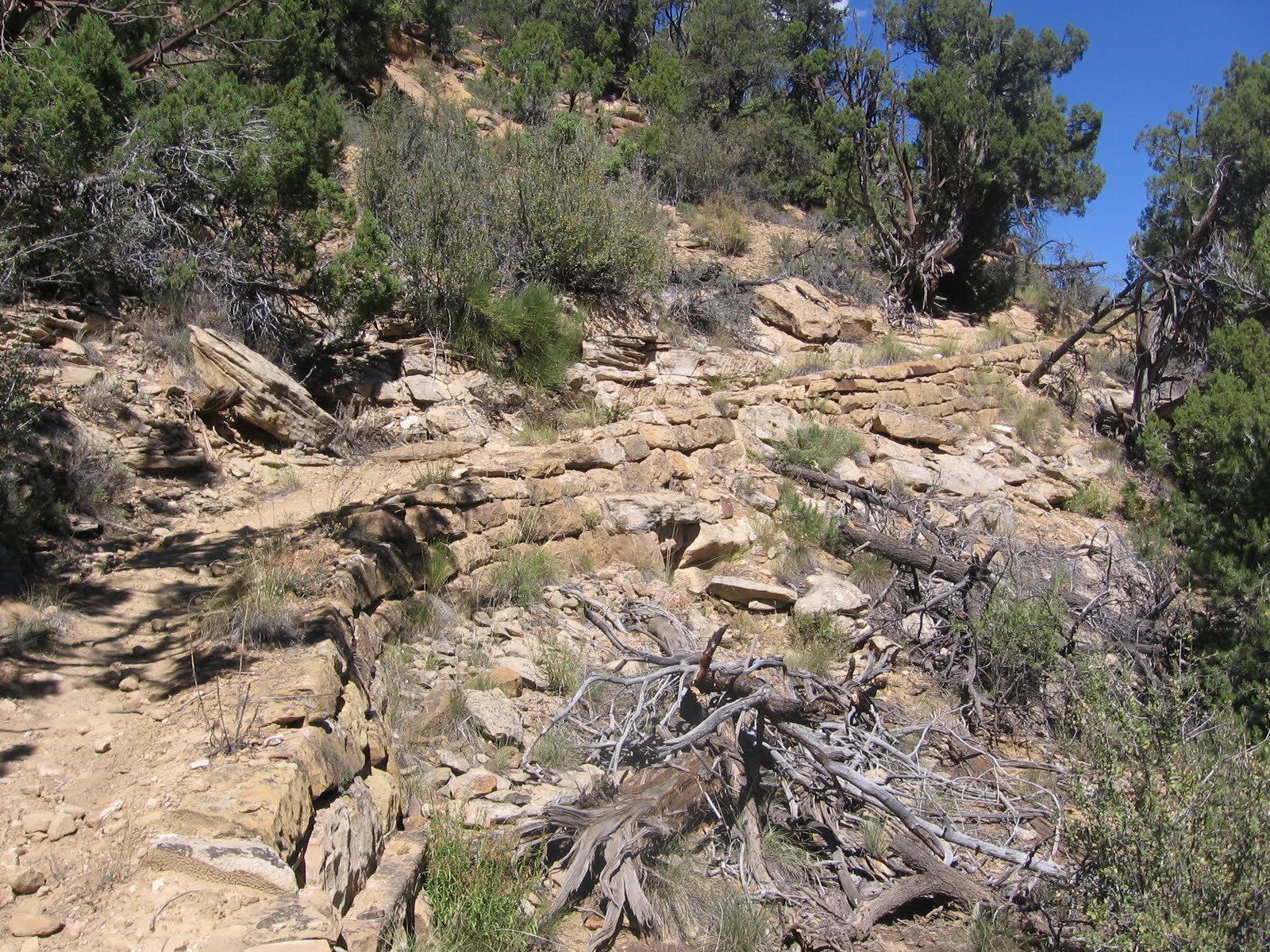
From the spectacular viewpoint, the trail plunges over the edge and down a long ladder. This segment is slow going down to a ledge area where the trail curls around the lookout point and up Johnson Canyon. The trail and ruins site has been stabilized recently.

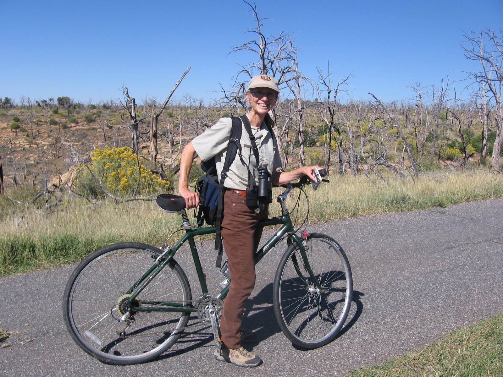
The Morris 3 site was first worked on by Earl Morris in 1913. It takes about one hour of travel on the gravel roads in Ute Mountain Park to arrive at the trail head, similar to most of the tours here.

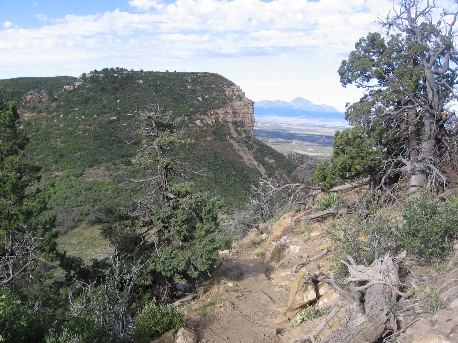
The trail is similar to the Petroglyph Trail in Mesa Verde, working along a cliff face below the rim but well above the canyon bottom. There are many ups and downs and careful stepping involved. There is a second small ladder about midway along the trail

Along the cliff face there are two small well preserved granary structures visible above the trail and a small alcove that is a ruins site, but without much stonework remaining. There is also a small granary site visible across Johnson Canyon and patches of Douglas Firs in the drainages across the way. There are supposed to be many rarely visited pit house sites on the mesa top across the canyon that Morris investigated long ago.

The stabilized trail enters the Morris 3 site from the left and crosses along the front with a route to enter for a close view. Our group size was only 11 and this was the first tour ever offered of this site.

The D shaped kiva at the back of the site was probably the most eye catching of the larger features. The large logs are still in place resting on the pilasters. The D shape is one of two side by side kivas partially tucked up under the alcove. The bottom features have been left unexcavated. Some of the plaster remains on the masonry interior walls.
Like many of the Mesa Verde area sites, different styles of masonry are visible. The Ute Mountain sites have been left much as they were originally found, with a lot of rubble still lying around the sites. There are also many pottery shards and corn cobs visible here. I saw mostly the corrugated style and not many with painted designs. The guide made the comment that in the early years of Mesa Verde, the boundary was not clear and many of the pottery shards from this site may have been collected by early visitors.

There is another large kiva on the right end of the site. The Morris 3 site has about 28 rooms and is thought to have been built around 1210 AD. It took our group 0:55 minutes of hiking from the trail head to arrive at the site, a distance of about 1.25 miles.

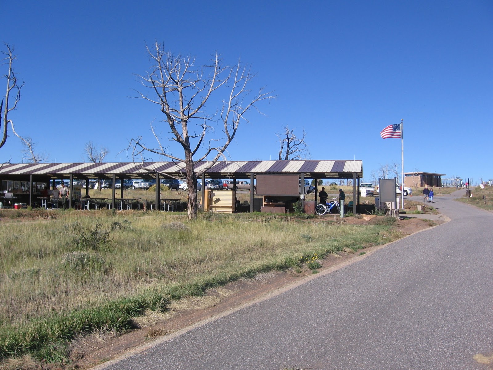
The tour visited the site for about 0:40 minutes and then we were allowed to return at our own pace to the trail head. There is a shade structure and picnic tables at the trail head where we rested and ate lunch for about 1:30 hours before traveling back to the visitor center.

The actual hike and ruins visit took about 2:30 hours for 2.5 miles out of a total experience of 5:45 hours. The cost of the tour was $38 which included riding in the van and a cold drink at the shade structure during the lunch break. This is one of the rare special experiences offered by Ute Mountain Tribal Park.