The
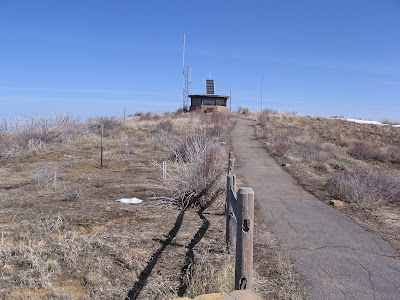
Park Point Trail at Mesa Verde is a short 0.4 mile paved trail to the highest point in the Park. In winter, the 0.5 mile paved road to the trail head might be closed. Adding the road up to the trail head, this a reasonable winter hike of about 1.5 miles to a good viewpoint.
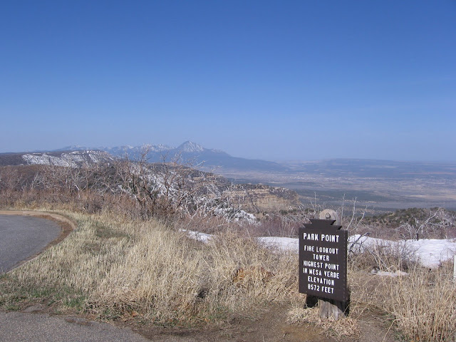
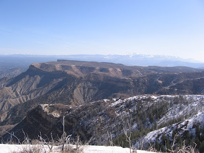
From this point at 8572 feet, there are 360 degree views around the Four Corners area. To the west are Sleeping Ute Mountain and the Blue Mountains and the LaSal Mountains in Utah. Interpretive signs discuss the recent history of forest fires in Mesa Verde. The year 2000 was a bad year for fire and the burned trees are evident throughout the park.
To the North are the San Juan Mountains of Colorado and to the South the Lukachukai Mountains in Arizona and Shiprock in New Mexico. As you are gazing at the views, the interpretive info reminds us that the views used to be better, air quality having declined in recent years.
One of the points visible on a clear day is Angel Peak in northwest New Mexico. When visiting Chaco Canyon, there is some interpretive information indicating that the mesa top sites were positioned so they could signal long distances, perhaps as far as Mesa Verde. The main cliff dweller sites at the south end of Mesa Verde don’t seem to be in good position to send or receive long distance signals. But at Park Point it seems possible that signals could be viewed from the Angel Peak or Huerfano area.
There is an old forest lookout station at Park Point. This function has now been mostly replaced by satellites. A peek inside shows the old range finder device and the map table. The other lookout stations in the region include the Benchmark Lookout to the northwest and Jersey Jim Lookout near Mount Hesperus and the Transfer campground to the northeast. My winter hike to Park Point took about 1:00 hour. In the summer season this is only a 30 minute visit.
In summer, the skeletons of the burned Gambel Oaks can be seen sticking up above the new growth. The Gambel Oaks appear to be recovering much faster than the Pinon Pine and Junipers that were burned in other parts of the park.
One of the interpretive signs at Park Point discusses “Dark Skies” and refers to the Ancestral Pueblo interest in astronomy. A small picture of the black Xs that are called Navajo Stars that are visible on the rock ceiling above Step House is included in the discussion.
On July 25, 2012, the flag near the forest lookout was flying at half mast in honor of the movie theater shooting victims near Denver.
.
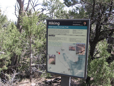 The name of Soda Canyon comes from the white mineral deposits left by seep springs near the canyon rim. This is a good trail to hike immediately following a tour of Balcony House.
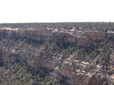


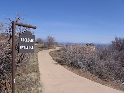 The interpretive signs describe how the alternate shale and sandstone layers, visible in the near distance, were deposited in geologic time.
