Sunday, May 30, 2010

Porcupine House Trail-Ute Mt. Tribal Park

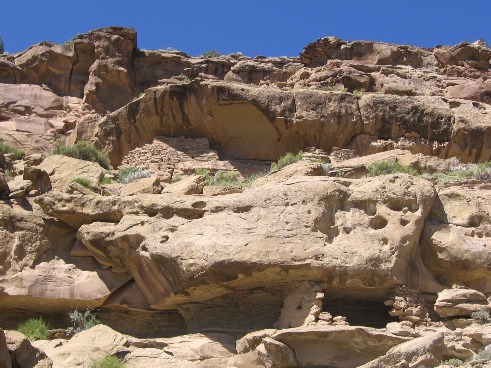
The Porcupine House Trail is an infrequently offered guided tour to an Ancestral Pueblo cliff dweller site in Ute Mountain Tribal Park in southwest Colorado. This tour was offered as part of the annual open house that is usually at the end of May.

The site location is in Pitch Pine Canyon, a side canyon of Johnson Canyon on the south side of Mesa Verde. The access is from the main park entrance at the lower end of Mancos Canyon south of Cortez, CO. It is in the vicinity of the regular full day tour hike at Lion Canyon.


From the canyon rim only the upper level of the site is visible. From above, it looked like there were a few storage ruins here, but much is obscured by the thick vegetation. The canyon floor vegetation is dominated by Gambel Oaks and Ponderosa Pines, an unusual combination in the areas where the cliff dwellings are found. Usually the Pinon Pines and Utah Junipers are found in these canyons with occasional Douglas Firs in the deeper and moister locations.


There are two ladders installed to descend. This canyon is oriented north and south with the main structures facing east rather than toward the more typical south. There is a collapsed tower on the rim right next to the ladders. There is a drainage channel from the rim area that flows across the rough slickrock right into the ruins area, but I didn’t see a seep spring here. The bottom area is very thick with the Gambel Oaks.

This site has been worked on to some extent, but not as much as the large and famous Mesa Verde sites. There is a trail marked along the front of the site and there has been some excavation in places. Most of the Ute Mountain sites have been left as they were found, with little work done on them.

The Ute Mountain sites feature a lot of artifacts on display. There are pottery shards, corn cobs, grinding stones and other small tools. The small guided groups have kept these artifacts available for viewing. Most of the pottery shards are the corrugated types that were typically from cooking pots. There are also some black on white designed pieces.


A large kiva that looks like it has had excavation work is one of the highlights. The Porcupine House has about 50 total rooms and about 5 kivas. The kiva has the bench and pilaster features that are common to the Mesa Verde style kivas. There isn’t room here to step back and get a wide view of the many rooms. All the views are close ups.
One of the unusual artifacts visible at this site was an example of a small sandal made from Yucca fiber. The guide mentioned that it was thought that Yucca had been planted at this relatively cooler site. Yucca was the main fiber that was available to the people living here. It is surprising that an item like that, more than 700 years old stays so well preserved. This site also had more grinding stones visible than most sites that can be visited.

At the end of the trail the group has to turn around and retrace their steps back to the starting point. There is an option to try climbing out along the original route in and out rather than climb the ladders.

The total tour to Porcupine House took 7:00 hours with about 2:00 hours spent at the site. There were also two stops at Mancos Canyon pictograph and petroglyph sites that are part of the regular tours. There were also stops at the park campground and the trailhead area for the regular tour of Lion Canyon.

Mancos Canyon Tour-Ute Mt. Tribal Park

Near the Mancos Canyon Road entrance to Ute Mountain Tribal Park in southwest Colorado are several easy to visit Ancestral Pueblo sites. These sites are part of the typical half day tour offered here. The full day tour goes on to the Lion Canyon Trail to visit a series of four cliff dwellings.


The Old Visitor Center was used from about 1971 to 1981 with the prominent Chimney Rock looming overhead. At first glance I thought this was an old jail. The wooden door was very thick and solid. Ute Mountain Tribal Park is the south side of Mesa Verde and is lightly visited.


The Red Pottery Village is an unexcavated village site where a lot of red pottery has been found. There are displays of pottery shards and artifacts in the field among the rubble mounds. The museums in the area say that the center of red pottery production was in southeast Utah and the Kayenta area of northeast Arizona, and any found near Mesa Verde would have been traded in.


This is one of the interesting features of the park, the visibility of these artifacts from a culture of more than 700 years ago. The artifacts are safe as all visitors are escorted by a guide. Across the canyon in this area a Hovenweep like tower is visible but the tour doesn’t go over to it.


Many Cliffs Ruins is a small site of small rooms tucked into the cliffs not far above the road. These small rooms are common in the region but are often overshadowed by the spectacular larger alcove ruins. Directly below the larger ruin and left of the smaller one there is an example of one of the Sun Calendar petroglyphs. There is a spiral and a grid that measures the movement of the sun, but it is hard to see from the road without binoculars.

About 200 yards back to the west of this site there is another petroglyph and pictograph panel with a trail up the cliff that allows a closer view. It may depend on who the tour guide is for the group to visit there.


There are many handprints, some broad shouldered figures and a footprint petroglyph. Occasionally there are special hikes that focus on the Sun Calendars along the Mancos Canyon. Usually the Sun Calendar hike is in late May.


The Chief Jack House Site was the home site of the last traditional chief of the Ute Mountain Utes and he was the one who proposed the Ute Mountain Tribal Park around 1970. There was initial opposition to the park and his house was burned down.


The Pictographs at the site are thought to have been painted by Chief Jack himself. The short Kiva Point Trail is also part of the Mancos Canyon Tour. There are easy to see petroglyphs and a large unexcavated Great Kiva.

The final stop in Mancos Canyon is the Kiva Point.  (Kiva Point has a separate post with more pictures.)


Thursday, April 22, 2010

Cliff Palace Foundations

The Cliff Palace Trail is one of three ranger guided tours to large ruins sites at Mesa Verde National Park in southwest Colorado. In 2010, both Cliff Palace and Balcony House opened for the season on April 11. The Cliff Palace Tour lasts for one hour.

The $3 tickets for tours are purchased at the Far View Visitor Center. Cliff Palace is the largest and most famous of the alcove Ancestral Pueblo ruins sites in the United States. The main topics of the tour focus on how why the alcoves were chosen as building sites after centuries of living on the mesa tops, and why they chose to leave after only about 100 years of inhabiting the alcoves.

When you visit these sites several times some of the finer details come into focus. While gathering for the first of three stops on the tour, on the left side of Cliff Palace, a large boulder appears to be built into the complex arrangement of rooms and towers. The ranger points out that the original surface of the alcove was uneven and the floor was leveled with rubble. The floor also seems to include a few of these very large boulders.


Looking closer, the individual stone bricks are fitted very carefully. In 1934, the Park Service was concerned about the stability of this boulder and installed 70 tons of steel and concrete to stabilize the rock. Seventy tons would be about 34 cubic yards or about 4 modern loads of concrete in the large mixer trucks. The current trail down from the canyon rim is narrow and has many twists and steps.

The task of getting that much material to the site seems difficult, but then it is small compared to what was accomplished 800 years ago when the site was originally under construction. When the park service started work, they found that some ancient masonry was already installed under the unstable boulder, indicating that the Ancestral Pueblo engineers were aware of the danger.

There are several advantages of alcove living including better shelter, conservation of fuel, and security of food supplies. One of the disadvantages is that rock slabs will fall from the ceiling. At Cliff Palace and the other main Mesa Verde sites, the fallen rubble has been cleaned up.

At nearby Ute Mountain Tribal Park and the many wild sites in the region, large slabs of sandstone are part of the scene. The Ranger mentioned that among the artifacts found at the Mesa Verde sites are prayer sticks, inserted in the developing cracks. One might think that the prayer sticks were inserted as an appeal to the spirits to secure the cracks, but the Ranger made it sound like they were also a warning device. While enjoying the day on the plaza, if a prayer stick suddenly hit the floor, don’t look up, dive for cover.


Friday, February 12, 2010

Far View Trail in Winter

The Far View Trail is about a 1 mile loop that leads to six mesa top sites at Mesa Verde National Park in southwest Colorado. During the winter months the short road and trail are not cleared of snow but it is still available for visiting.

During February 2010, the snow at Far View was so deep it nearly covers the interpretive signs, so bring your snow shoes. It is about 0.25 miles from the main park road to the open plaza area between Far View House and Pipe Shrine House. The Far View Trail is flat, without any hidden hazards. The Far View sites are very good, but they seem to be ignored in favor of the spectacular cliff dweller sites for which Mesa Verde is most famous.

The interpretive sign at my feet describes how Far View was first investigated by Jesse Fewkes in 1916. Dr. Jesse Fewkes first arrived at Mesa Verde in 1907 as the primary archaeologist.

Pipe Shrine House is just a short walk south of Far View House. The low walls of Pipe Shrine were nearly covered completely, with only the kivas showing much of the stonework. Far View was one of the most densely populated areas of Mesa Verde with 50 villages within a square half mile. Only six are excavated for visitors.

The Far View Tower is a short distance north of Far View House. There is a tower and kiva combination here that draws interest. Some of the towers are positioned with good views so that they appear to be lookout towers. The Far View Tower is not positioned with a good view. Looking at it in winter with several feet of snow on the ground, it looks like a place to store food and fuel while taking refuge in the earth contact kiva. The elevated structure would also be a place to get out above the snow line on a sunny day like this one.

I continued north to the Mummy Lake Reservoir to find it completely filled with unmelted snow with only a few of the stones visible. No one else had hiked that far since the most recent snow. The snow surface was a little soft and I was sinking in 6” or so on most steps. Mummy Lake is one of four constructed reservoirs at Mesa Verde and the only one that is accessible.

I didn’t try to get to the small Megalithic House site. I made it to the Coyote Village site to the south of Far View House. No one else had tried to go there either and it was hard to see where the trail was, but I knew the way from previous visits.  I spent about 1:00 hour in the deep snow Far View area on a 30 F degree early February day.


Square Tower House Overlook Trail and Pit Houses

The Square Tower House Trail is a 500 foot paved route to an overlook of the Square Tower alcove ruins site. It is the third stop on the Mesa Top Pithouse to Pueblo Tour at Mesa Verde National Park in southwest Colorado..

The Pithouse to Pueblo Tour is self guiding and visitors usually move their vehicles from stop to stop. During the winter months, the road and short trails are cleared of snow. The section from Square Tower to Sun Point, or further to Sun Temple, is a good hiking opportunity on a hard surface with little traffic.

It is thought that the site of Square Tower House was used as a resting and storage site very early in the human history of the Mesa Verde area. A storage pit was found here from the era when farming on the mesa tops was just beginning. Centuries later, after life on the mesa top was well established, the alcove was re-established as a residence site. At 28 feet tall, the Square Tower is the tallest structure in Mesa Verde.


The Square Tower site is thought to have been built and used during the years from 1200 to 1300 AD. About 60 of the original 80 rooms are still standing. There is a seep spring below the alcove that provided water. Square Tower has a little known neighbor to the north, around a corner called Little Long House that isn’t visible from a road side viewpoint. An unmarked side trail near the petroglyph on the Petroglyph Trail leads to a viewpoint.

My pictures of this site in the summer show more shade, while in winter the site gets full sun, just the way you would want it. For a hiker, there is the opportunity for a 3 mile round trip hike to the Sun Point area with several sites to visit along the way. (In 2011 and 2012 there have been ranger guided hikes down into the Square Tower House alcove. Use the label Square Tower House Guided Hike to find more info.)

These sites explain the development of living styles from the first pit houses to the large alcove sites visible at sun point. On a sunny winter day this is a very pleasant walk when the other trails are snow covered. In early February I walked on a sunny 30 F degree day with at least two feet of snow along the roadside.

The first permanent dwellings in the Mesa Verde region were the Pit Houses. These living spaces are numerous at Mesa Verde but only a few are developed for viewing along the trails. The Chapin Mesa Pit House to Pueblo Tour and the Badger House Trail on Wetherill Mesa have several exhibits under protective roofs that show the development of the early pit houses into the large alcove sites for which Mesa Verde is famous.


The pit house sites don’t look like much at first glance as they only show the pits and not the roofing or any of the artifacts of everyday life. The small opening between the two pits is the ventilation shaft, allowing fresh air in as the smoke from the fire pit rises and exits through the roof opening. The ventilation systems are among the many clever features that we see in the more advanced kivas. Sifting through the debris of these sites, charred materials are often found indicating that fires occurred here frequently.

The fourth stop on the Chapin Mesa Pit House to Pueblo tour shows the smaller pit to have been converted into the main living area after a fire. The same stop has an example of the beginnings of above ground room blocks. The pit rooms gradually became deeper and became the stone lined kivas that we see at the alcove and advanced mesa top sites.


The interpretive signs at these sites emphasize the religious and ceremonial nature of these excavated chambers, but when visiting here in February when the temperatures are below freezing and there is several feet of snow on the ground it seems that keeping warm would be the priority concern,

The Mesa Verde area was abandoned by about 1300 AD for reasons that are not clear. Among the reasons could be that by 1300, the large population here had used up all the winter fire wood. There was a burst of alcove building from 1200 to 1300.Viewing the many alcove sites at nearby Sun Point in winter, the alcoves are sunny and snow free while the mesa top is still frozen under deep snow.


The Anasazi Heritage Center in nearby Dolores, CO has a reconstructed pit house inside the museum. The construction details of the roof aren’t as clear as at Step House but the smaller sunken area in front of the pit house is well illustrated with some typical artifacts including pottery, baskets, an ax and a grinding stone.


There is a display of pictures that shows the experience of an archaeologists attempt to build a pit house today. It is mentioned that it took 8000 strokes with a stone ax to cut an 11.5 inch log. This seems to be about 12 hours of chopping per log.


544544_$20 off any hotel booking of $350 or more with code TLSALE20