Sunday, February 17, 2013

Mesa Verde Winter Animal Tracks and Signs Interpretive Hike

The Animal Tracks and Signs Interpretive Hike is part of a series of six special hikes in the 2012-2013 Southwest Colorado Winter Ecology Series offered in the Mesa Verde region. The Animal Tracks Hike was re-offered on February 16, 2013 after bad weather made conditions difficult on the original January 23 date.


The Tracks Hike explored the mountain shrub environment of the 7800 feet elevation Morefield Canyon Campground area. As part of the Mesa Verde effort to attract more winter visitors, 4.8 miles of groomed snow trails have been prepared in the Morefield Campground area.

Other areas of Mesa Verde also have groomed winter trails and the Mesa Verde web site has maps and up to date information on the conditions of these trails. There has been more snow in the 2013 winter than relatively light 2012. (Use the “snowshoe hikes” label to find these other trails.)


Mesa Verde National Park received a grant of $9765 from the Active Trails Program of the National Parks Foundation in 2012 to develop winter snow shoe and ski trails. Part of the funding was used to purchase snow shoes that are available for free loan to anyone interested in winter hiking at the park. They are available at the new Visitor Center and the Chapin Mesa Museum.

The first part of the hike included an introduction to animal tracks and emphasized Gestalt Tracking. Gestalt is a German word for form or shape. It is used in English to refer to a concept of wholeness.


Individual animal tracks in snow might be hard to identify, but the using of  the gestalt approach considers the animals range and habitat for the season, where to the tracks come and go from, what line does it follow (zig zag?). Also consider the size and shape, number of toes, claws, stride and straddle, gait pattern, and other signs like scat and smells. (in the 2012 Winter Ecology Hike there is more information on these details.)


The Morefield Campground area is dominated by Gambel Oak (Quercus gambelii), while most of Mesa Verde is Pinon and Juniper forest. At one trail stop there was a short discussion of the purplish Colorado Hairstreak Butterfly, (Hypaurotis crysalus) the state butterfly of Colorado since 1996. This choice was due to the steady lobbying of 4th graders from Wheeling Elementary in Aurora, Colorado (led by teacher Melinda Terry).

This butterfly species depends upon the Gambel oak which is both the favorite roost of adults and usual food source for caterpillars. Eggs are laid singly in late summer on twigs of Gambel oaks or another oak species. The caterpillars emerge in the spring and eat young leaves. Adults feed on tree sap and probably honeydew secreted by other insects rather than on flowers. The species has one flight, usually from mid-June to August.

The winter ecology brochure available at the trail head also has a paragraph on observing insect formed galls on trees and shrubs but doesn't mention any specific insects.


There was also a demonstration of the use of motion activated cameras for the purpose of studying wildlife. Some of the current use of these cameras at Mesa Verde is to study the interaction of feral horses with the native deer and elk. There is a current project in the park concerning what to do about the 100-150 feral horses that range through the park and are trampling some of the remote archaeology sites.


The most common tracks that we saw were coyote and cottontail rabbits. Here, we’re looking at some smaller stride and straddle canine tracks that could be from a fox.


We also saw tracks that we thought could have been a bobcat, and some that might have been a weasel. We didn't see any mule deer tracks as they prefer to move down to less snowy conditions. We spent about 3:00 hours on the entire hike but only covered about 1 mile in slow walking with frequent stops. It was a perfect sunny 25 F degree mid February morning and there were about 16 hikers in the group.


The Visitor Center bookstore has a simple pocket field guide to animal tracks available for $5.95. This guide is for all of North America so the user will have to apply the gestalt principle to use it effectively at Mesa Verde.


Mesa Verde Winter Festival 2013

The first annual Mesa Verde Winter Fun Festival was held on February 23, 2013 in the Morefield Campground area. A main event three-mile fun cross country ski race was held on the Meadow Bliss Trail at 11:00 AM.


During and after the race there was a hands-on primitive skills demonstration including bow and drill fire starting, atlatl usage and yucca cord making. The fire starting demonstration was actually successful. The bow spun the yucca stalk drill on a piece of soft wood and produced smoke and a small coal. Using some easily combustible plant material that looked like Juniper bark, blowing on the coal produced a flame.


The atlatl was a device that increased the leverage for throwing spears or arrows. There was a supply of arrows on hand and a small target range was set up. It takes some practice to get the hang of throwing.


It was a good day for snow shoe hiking on the Morefield Campground Trails. One of the options includes a flagged route from the parking area to the trail head of the Point Lookout Trail. This route cuts across the north side of the campground loops and includes some segments through the groves of Gambel Oak.


Part of this route passes through the amphitheater area. Although this isn't a long distance, it takes extra effort to push through the ungroomed snow. In the evening, there was a planned opportunity for skiing or snow shoeing by the full moon.


18407_$5 Shipping on Orders of $99 or More!

Tuesday, January 22, 2013

Ancient Skywatchers at the Mesa Verde Sun Temple

The Sun Temple is one of ten stops on the Mesa Top from Pithouse to Pueblo Tour at Mesa Verde National Park in southwest Colorado. The Ancient Skywatchers of the Southwest Exhibit at the Anasazi Heritage Center in Dolores, Colorado features the view between the Sun Temple and the famous Cliff Palace.


On the east side of the Sun Temple, there are views toward Cliff Palace. At the south end of Cliff Palace there is a tall square tower that has interior pictographs near the top. These pictographs can be viewed at the end of the regular Cliff Palace tours by leaning in the doorway and looking up. The Skywatchers Exhibit has some close up pictures of the pictographs.


A Skywatcher interpretation of these pictographs is that they are a record of observations of the lunar standstill. Every 18.6 years the change from north to south in the monthly orbit of the moon is a maximum and the Ancestral Pueblo Skywatchers seemed to be aware of this.

The Chimney Rock National Monument near Pagosa Springs, Colorado is thought to be a site where the lunar standstill was observed between the unusual Chimney Rock peaks.


There are boulders on the north side of the Sun Temple that allow a view into the interior of the structure where there are two circular structures. It is possible that the Cliff Palace view toward the setting moon during the lunar standstill passed between these two circular structures like a gun sight, similar to the view at Chimney Rock.

It isn't possible for visitors to see between the circular structures now, but researchers with survey equipment have made this observation.


On the southwest corner of the Sun Temple, there is an unusual depression in the rocks with rays radiating out. The trail guide for the Mesa Top Tour says that Jesse Walter Fewkes thought this small basin was a “solar marker”. It may have been a place to leave offerings to the sun.


On the boulders on the north side of the Sun Temple, there is a small circular basin. Researchers have found about 200 small basins like this at Mesa Verde and it may be a Skywatcher observation point.

During the winter, the Mesa Top Tour road is cleared of snow and there are ten sites to visit. This is a reasonable place to walk when other park trails are snow covered.

18407_$5 Shipping on Orders of $99 or More! 544544_$20 off any hotel booking of $350 or more with code TLSALE20

Saturday, December 22, 2012

Mesa Verde New Visitor Center


The new Mesa Verde National Park Visitor and Research Center opened for visitors in mid December 2012. It is located just outside the main park entrance and there is no charge to enter.

For visitors, it provides an introduction to the park and includes tickets for the main tours and a bookstore. The Chapin Mesa Museum continues as the main place to see artifacts and detailed explanations.


One of the displays inside the entrance discusses the steps taken to make this new facility a very green building. Emphasis was placed on conserving energy and water, and using environmentally friendly materials. The building is highly insulated and has large windows that capture solar heat in winter but prevent heat loss. Photovoltaic panels capture sunlight and convert it to electrical power.


The Ancestral Pueblo archaeology introduction uses a format of the questions of Who are we? Why were we here? How did we live here? And where are we now? The how did we live here segment has the most eye catching display. On one side there is a figure climbing hand and toe holds.


Below the climber, a woman at a seep spring uses a pottery dipper to transfer water to a pottery jar. All of the interpretive signs provide tips where in the park you can see real examples of the images depicted,  such as actual seep springs with similar small chiseled basins.


The opposite side of the same display shows a stone worker shaping one of the many sandstone bricks needed for the extensive structures. The development of masonry and building styles is one of the most amazing aspects of Mesa Verde.


The Where are we now exhibit shows a map of where current pueblo people live. One of the main questions about Mesa Verde is what caused the burst of alcove building in the 1200s and why did the Ancestral Pueblo people then abandon the area so abruptly about 1300 AD.

This exhibit includes some audio samples of the languages that are now spoken by Pueblo people. Four different Pueblo languages are mentioned plus the Navajo language.


Most of the new facility is devoted to research and storage of artifact collections. There are large windows that provide a glimpse into the facility but the view is mostly of cardboard boxes. There is a computer display near the windows that provides some information on the types of materials that are stored here.


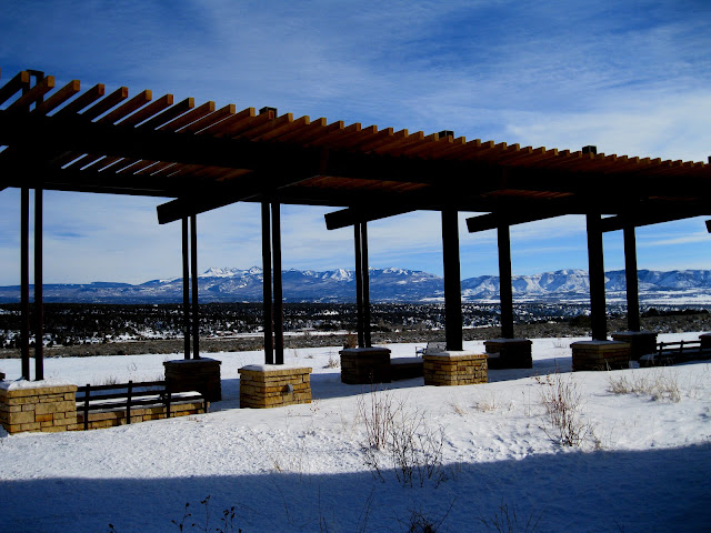
On the north side of the new Visitor Center there are large ramada shaded areas and benches with good views toward Mt. Hesperus and the LaPlata Mountains. My visit was in late December about 9 days after the opening. Despite the winter conditions there was a steady flow of visitors.

Sunday, September 23, 2012

Hike and Bike on Wetherill Mesa


Wetherill Mesa at Mesa Verde has the second largest concentration of Ancestral Pueblo ruins sites in the park, but is usually only open in the summer season between Memorial Day and Labor Day.

The southwest Colorado National Park held a special Wetherill Mesa Hike and Bike day on September 22, 2012. The Wetherill Mesa Road was open to entry from 9:00 AM to 3:30 PM with all visitors leaving by 4:30 PM.


The 5.4 mile paved tram road is open for hiking and biking to the several sites. Visitors park at the information kiosk as usual, and then set out on the tram road or the normal hiking trail. Staying on the tram trail, the first attraction is the 1 mile round trip Nordenskiold Site #16 Trail. 


The Nordenskiold Trail leads to a lookout point of the No. 16 site that features about 50 rooms and 5 or 6 kivas. This site has a round tower on the right side and perhaps a squarish kiva on the left side. There is a site diagram on the interpretive sign at the overlook point.


A small ruins site in visible with binoculars across the scenic Rock Canyon when looking to the west from the same viewpoint.


Long House is a good place to visit on the Hike and Bike days. The hike along the tram trail to the Long House trailhead is about 0.75 miles and takes me about 20 minutes if there are no other stops. Normally, visitors arrive on the tram and hike in groups of up to 60 with no little opportunity to pause along the trail and take in the views or examine the Pinon Pine and Utah Juniper forest.


This is a good opportunity to notice Long House details that might normally be missed. I noticed a doorway on the right side of the large Long House site that seems to have an inside stairway leading down to it.


In the same area I noticed a T-shaped doorway. There is some mystery about this type of doorway. Is it practical or does it have some symbolic meaning.


After visiting Long House, I returned on the tram road and walked back to the busy kiosk. As part of the special day, a hamburger or hot dog and chips lunch was available at the kiosk for $5 or $6. My hike and visit to the Nordenskiold Trail and Long House took 2:30 hours for about 4 miles of walking. It was an 80 F degree late September day and there were dozens of other visitors enjoying the day.


Friday, September 7, 2012

Inside Mesa Verde Square Tower House


During the 2012 season at Mesa Verde National Park in southwest Colorado, ranger guided hikes into the Square Tower House site were offered on Tuesdays, Thursdays and Saturdays from May 26 to June 16 and from September 4 to October 6. These tours start at 8:00 AM and last about 2 or 2.5 hours. There is a $25 charge and reservations have to be made. Each tour is limited to 10 hikers.


Square Tower House site was occupied from the mid 1100s to the late 1200s. The site contains about 49 rooms and 8 kivas. The eye catching structures are the 28 foot tall Square Tower and the Crow’s Nest high in a crevice.


The Square Tower House alcove isn't as deep as some of the other large sites at Mesa Verde. This might explain the exceptional height of the Square Tower House. The builders were forced to build upwards to add more rooms.

On the left side, there is a rebuilt section against the back of the alcove that was supervised by Jesse Walter Fewkes in 1919 to prepare the site for visitation by the public. Square Tower House was visited by the public in the 1920s and 1930s but has been visible only from the overlook until tours resumed in 2011.


From the right side view it appears that the all but the top floor have entry ways on the front and the right side. It also appears that there were balconies on the right side.


The lowest levels of the Square Tower have some T-shaped doorways. This is the tallest structure in Mesa Verde.

Like many of the large alcove sites at Mesa Verde, the builders incorporated the naturally occurring boulders into the structures.


Our group of 10 spent a total of 2:30 hours visiting Square Tower House on an early September morning. It was comfortably cool 60 F degrees at 8:00 AM and most of the hike is in shade.


Around the corner from Square Tower House is the seldom seen Little Long House. The 2011 and 2012 Square Tower House tours haven’t gone there but probably could.


 Little Long House is supposed to have a better source of water than Square Tower House.

(There is another post on Square Tower House that shows more of the overall features. Use the labels Square Tower House Guided Hike to find.)